|
1
|
ARP coordinates and site at AD
|
512700N 0052228E
300° GEO 320 M from TWR. |
|
2
|
Direction and distance from (city)
|
4 NM W of Eindhoven
|
|
3
|
Elevation / reference temperature
|
ELEV: 74 FT AMSL / T: 22.3 °C
|
|
4
|
Geoid undulation at AD ELEV PSN
|
144 FT
|
|
5
|
MAG VAR / annual change
|
2.6° E (2025) / 0.2° E
|
|
6
|
AD operator, address, telephone, telefax, email address, AFS, URL
|
EINDHOVEN AIRPORT N.V.
LUCHTHAVENWEG 13 5657 EA EINDHOVEN THE NETHERLANDS TEL: +31 (0)40 291 9823 email: [email protected] AFS: EHEHYDYX URL: https://www.eindhovenairport.nl |
|
7
|
Types of traffic permitted (IFR/VFR)
|
IFR/VFR
|
|
8
|
Remarks
|
AD operator
- Military administration: - Post: RNLASF Vliegbasis Eindhoven MPC 87A P.O. Box 8762 4820 BB Breda The Netherlands - TEL: +31 (0)40 289 6240 (OPS, H24) - TEL: +31 (0)40 289 6314 (Handling, during office HR) - Fax: +31 (0)40 289 6466 - AFS: EHEHZTZX - For MIL PPR: send email to [email protected], or call OPS or Handling. |
|
1
|
Hotels
|
One at the airport and numerous in Eindhoven.
|
|
2
|
Restaurants
|
At the airport and numerous in Eindhoven.
|
|
3
|
Transportation
|
Buses and taxis.
|
|
4
|
Medical facilities
|
First aid treatment and first responders on site. Hospitals in Eindhoven (8 KM).
|
|
5
|
Bank and post office
|
Bank: at the airport (including ATM).
Post: In Eindhoven. |
|
6
|
Tourist office
|
In Eindhoven.
|
|
7
|
Remarks
|
Hotels
- At the airport: Tulip Inn Eindhoven Airport (120 rooms) - TEL: +31 (0)40 303 0615 - Email: [email protected] |
|
1
|
Use of aircraft stand ID signs, TWY guide lines and visual docking/parking guidance system at aircraft stands
|
- Marshaller will provide guidance to the aircraft stand. Follow-me car is available on request.
- For parking stand RA1 a follow-me car will provide guidance to the aircraft stand. - ATC will issue the ACFT stand number, see aircraft parking / docking chart (APDC). Aircraft may only leave the taxiway centreline after visual contact with the marshaller. - General aviation: ATC instructs pilots entering the civil apron to report "marshaller in sight" and follow the marshaller's instructions to the allocated aircraft stand. - Oversteering on taxiways required for AN124, B747-8 and C5/C5M. |
|
2
|
RWY and TWY markings and LGT
|
RWY markings
- RWY 03: DTHR, designation, TDZ, aiming point, CL, edge. - RWY 21: DTHR, designation, TDZ, aiming point, CL, edge. RWY LGT - RWY 03: THR, edge, RWY end. - RWY 21: THR, edge, RWY end. TWY markings - CL. - Holding positions. - Mandatory red/white instruction signs. TWY LGT - Edge. - Retroreflective edge markers. |
|
3
|
Stop bars
|
NIL
|
|
4
|
Remarks
|
NIL |
|
1
|
Associated MET office
|
DE BILT
|
|
2
|
Hours of service
MET office outside hours |
Hours of service
H24 MET office outside hours NIL |
|
3
|
Office responsible for TAF preparation
Period of validity |
Woensdrecht (Joint Meteorological Group)
30 HR |
|
4
|
Trend forecast
Interval of issuance |
TREND
Every 30 MIN during AD OPR HR. |
|
5
|
Briefing/consultation provided
|
Self-briefing; briefing on request from MWO-De Bilt by telephone after self-briefing.
TEL: 0900 202 3341 Briefing low level flights (IFR/VFR). TEL: 0900 202 3343 Briefing IFR flights above FL 100. TEL: 0900 202 3340 Briefing balloon flights within Amsterdam FIR. Weather bulletin (Dutch language) and METARs via Dutch public television 'Teletekst' page 707. |
|
6
|
Flight documentation
Language(s) used |
Reports, forecasts, charts.
English, Dutch. |
|
7
|
Charts and other information available for briefing or consultation
|
S, P, W, T
|
|
8
|
Supplementary equipment available for providing information
|
WXR, APT
|
|
9
|
ATS units provided with information
|
Eindhoven TWR
|
|
10
|
Additional information (limitation of service, etc.)
|
Briefing/consultation provided
- charge for TEL briefings and consultations is € 0,50/MIN. |
|
RWY designation
|
True BRG
|
Dimensions of RWY (M)
|
Strength (PCN) and surface of RWY and SWY
|
THR coordinates
RWY end coordinates THR GUND |
THR ELEV and highest ELEV of TDZ of precision APCH RWY
|
|---|---|---|---|---|---|
|
1
|
2
|
3
|
4
|
5
|
6
|
|
03
|
034.99°
|
3000 x 45
|
RWY: 58/F/A/W/T
PCR 564/F/A/W/T Asphalt SWY: NIL |
THR:
512627.19N 0052150.96E RWY end: 512740.23N 0052312.81E THR GUND: 144.0 FT |
THR: 74.0 FT
TDZ: 73.0 FT |
|
21
|
215.01°
|
3000 x 45
|
RWY: 58/F/A/W/T
PCR 564/F/A/W/T Asphalt SWY: NIL |
THR:
512733.79N 0052305.60E RWY end: 512620.70N 0052143.69E THR GUND: 144.0 FT |
THR: 67.0 FT
TDZ: 68.1 FT |
|
RWY designator
|
TORA
(M) |
TODA
(M) |
ASDA
(M) |
LDA
(M) |
Remarks
|
|---|---|---|---|---|---|
|
1
|
2
|
3
|
4
|
5
|
6
|
|
03
|
3000
|
3060
|
3000
|
2757
|
DTHR 244 M.
|
|
03
|
2751
|
2811
|
2751
|
NIL
|
Take-off from intersection with TWY: R6
|
|
03
|
1918
|
1978
|
1918
|
NIL
|
Take-off from intersection with TWY: L5
|
|
03
|
1918
|
1978
|
1918
|
NIL
|
Take-off from intersection with TWY: R5
|
|
21
|
3000
|
3060
|
3000
|
2757
|
DTHR 244 M.
|
|
21
|
2751
|
2811
|
2751
|
NIL
|
Take-off from intersection with TWY: L2
|
|
21
|
2751
|
2811
|
2751
|
NIL
|
Take-off from intersection with TWY: R2
|
|
21
|
2250
|
2310
|
2250
|
NIL
|
Take-off from intersection with TWY: L3
|
|
21
|
2250
|
2310
|
2250
|
NIL
|
Take-off from intersection with TWY: R3
|
|
21
|
2016
|
2076
|
2016
|
NIL
|
Take-off from intersection with TWY: L4
|
|
21
|
2016
|
2076
|
2016
|
NIL
|
Take-off from intersection with TWY: R4
|
|
RWY
designator |
RWY edge LGT
length spacing colour INTST |
RWY end LGT
colour WBAR |
SWY LGT
length colour |
Remarks
|
|---|---|---|---|---|
|
1
|
7
|
8
|
9
|
10
|
|
03
|
3000 M
30 M W LIH |
NIL
|
NIL
|
RWY edge LGT
Colour: red from beginning of RWY to DTHR; white from DTHR to 600 M before RWY end; yellow last 600 M before RWY end. RWY end LGT 3 red, 1 green, 3 red (for military reasons). |
|
21
|
3000 M
30 M W LIH |
NIL
|
NIL
|
RWY edge LGT
Colour: red from beginning of RWY to DTHR; white from DTHR to 600 M before RWY end; yellow last 600 M before RWY end. RWY end LGT 3 red, 1 green, 3 red (for military reasons). |
|
1
|
ABN/IBN location, characteristics and hours of operation
|
NIL
|
|
2
|
LDI location and LGT
Anemometer location and LGT |
LDI: NIL
Anemometer: several on the airfield; 125 M NW of TWR, 50 M NW of THR RWY 03 and 50 M NW of THR RWY 21; not lighted. |
|
3
|
TWY edge and centre line lighting
|
NIL
|
|
4
|
Secondary power supply
Switchover time |
NIL
|
|
5
|
Remarks
|
NIL
|
|
Designation and lateral limits
|
Vertical limits
|
Airspace classification
|
ATS unit
call sign language(s) |
Transition altitude
|
Hours of applicability
|
Remarks
|
|---|---|---|---|---|---|---|
|
1
|
2
|
3
|
4
|
5
|
6
|
7
|
|
EINDHOVEN CTR
(EHEH) 513853N 0052323E - 512734N 0054129E - 512121N 0053130E along clockwise arc (radius 8 NM, centre 512700N 0052228E) - 513239N 0051324E - 513853N 0052323E. |
D
|
Eindhoven Tower
English |
3000 FT AMSL
|
0600-2300 (0500-2200)
|
NIL
|
|
Service
designation |
Call sign
|
Channel(s)
|
SATVOICE NR
|
Logon address
|
Hours of operation
|
Remarks
|
|---|---|---|---|---|---|---|
|
1
|
2
|
3
|
4
|
5
|
6
|
7
|
|
APP
|
RAPCON South
|
123.180
|
NIL
|
NIL
|
MON-FRI 0700-1545 (MON-FRI 0600-1445)
|
PRI
|
|
122.100
|
NIL
|
NIL
|
0600-2300 (0500-2200)
|
NIL
|
||
|
388.525
|
NIL
|
NIL
|
MON-FRI 0700-1545 (MON-FRI 0600-1445)
|
PRI
|
||
|
Eindhoven Arrival
|
124.530
|
NIL
|
NIL
|
0600-2300 (0500-2200)
|
PRI
VDF |
|
|
122.100
|
NIL
|
NIL
|
0600-2300 (0500-2200)
|
NIL
|
||
|
132.530
|
NIL
|
NIL
|
0600-2300 (0500-2200)
|
VFR traffic crossing Eindhoven TMA.
|
||
|
265.975
|
NIL
|
NIL
|
0600-2300 (0500-2200)
|
PRI
|
||
|
TWR
|
Eindhoven Tower
|
131.005
|
NIL
|
NIL
|
0600-2300 (0500-2200)
|
PRI
VDF |
|
122.100
|
NIL
|
NIL
|
0600-2300 (0500-2200)
|
NIL
|
||
|
241.550
|
NIL
|
NIL
|
0600-2300 (0500-2200)
|
PRI
|
||
|
GND
|
Eindhoven Ground
|
121.930
|
NIL
|
NIL
|
0600-2300 (0500-2200)
|
NIL
|
|
335.750
|
NIL
|
NIL
|
0600-2300 (0500-2200)
|
NIL
|
||
|
ATIS
|
Eindhoven Information
|
126.030
|
NIL
|
NIL
|
0600-2300 (0500-2200)
|
Coverage 60 NM/20 000 FT.
|
|
Type of aid
MAG VAR Supported OPS ILS CAT GBAS facility (VOR/ILS/MLS declination) |
ID
|
Frequency
CH Service provider Reference path ID |
Hours of operation
|
Position of transmitting antenna
|
DME: ELEV
transmitting antenna GBAS: ELEV ellipsoid height reference point SBAS: ellipsoid height LTP/FTP |
GBAS
reference point service volume radius |
Remarks
|
|---|---|---|---|---|---|---|---|
|
1
|
2
|
3
|
4
|
5
|
6
|
7
|
8
|
|
DVOR/DME
(02° E) (decl.: 2°E) |
RTM
|
110.400 MHz
CH 41X |
H24 |
515825.3N
0042851.5E |
0 FT
|
NIL
|
50 NM/250 FL
in sector 029°-239° MAG 100 NM/250 FL in sector 239°-029° MAG |
|
TACAN
|
EHV
|
CH 119X
|
H24 |
512653.4N
0052229.8E |
100 FT
|
NIL
|
150 NM/60000 FT
in sector 000°-360° MAG RNLASF. |
|
GP 03
|
EHZ
|
333.050 MHz
|
H24 |
512634.2N
0052206.4E |
NIL
|
NIL
|
363 M past THR RWY 03.
|
|
LOC 03
(03° E) ILS CAT I/C/1 (decl.: 3°E) |
EHZ
|
109.750 MHz
|
H24 |
512745.0N
0052318.2E |
NIL
|
NIL
|
430 M from THR RWY 21.
|
|
DME 03
|
EHZ
|
CH 34Y
|
H24 |
512634.2N
0052206.4E |
100 FT
|
NIL
|
Situated on GP 03. One direction only.
|
|
DME 21
|
EHO
|
CH 34Y
|
H24 |
512722.3N
0052301.6E |
100 FT
|
NIL
|
Situated on GP 21. One direction only.
|
|
GP 21
|
EHO
|
333.050 MHz
|
H24 |
512722.3N
0052301.6E |
NIL
|
NIL
|
358 M past THR RWY 21.
|
|
LOC 21
(03° E) ILS CAT I/C/1 (decl.: 3°E) |
EHO
|
109.750 MHz
|
H24 |
512615.1N
0052137.4E |
NIL
|
NIL
|
462 M from THR RWY 03.
|
|
GPS
|
NIL
|
L1
1575.42 MHz |
H24
|
NIL
|
NIL
|
NIL
|
NIL
|
|
EGNOS
|
NIL
|
L1
1575.42 MHz |
H24
|
NIL
|
NIL
|
NIL
|
See EHEH AD 2.22 for FAS data block
|
- Commercial aviation: Flights carried out by an airline that offers regular services and/or scheduled irregular services or ad hoc transport and/or freight and/or post, including positioning flights that are directly related to these flights.
- General aviation: Operations with a civil aircraft, whether or not at a fee or against payment of rent, other than commercial traffic.
- Business aviation: The sector of general aviation that pertains to the operation or use of aircraft by businesses for the carriage of passengers (including the provision of taxi services or the carriage of goods as part of their business operations; the pilots need to have at least a valid commercial pilot licence with a qualification for flying with the use of instruments). These flights are generally not open for the public.
-
Slot requests for commercial aviation must be filed in the slot clearance request (SCR) format according the IATA standard schedule
information manual (SSIM) Chapter 6. - The requests must include information about the flight number or registration number and the desired date/time.
-
Slot requests shall be submitted to Airport Coordination Netherlands (ACNL):
Email: [email protected] -
Contact information ACNL during office hours:
Tel: +31 (0)20 405 9730 URL: https://www.slotcoordination.nl
General aviation is co-ordinated through PPR. An allocated PPR number should be filed in item 18 of the flight plan. General aviation flights are prohibited to operate to and from Eindhoven Airport without a valid PPR number. Requests for PPR must be filed at
https://ppr.eindhovenairport.nl/customer/account/login/reference. The PPR procedures for general aviation and business aviation are available on:
https://www.eindhovenairport.nl/en/general-aviation-business-aviation.
Business aviation flights are prohibited to operate to and from Eindhoven Airport without a valid approval from Eindhoven Airport. Business aviation flight requests to be send to:
| Email: | [email protected] |
Ground handling is mandatory for all civil aircraft (see EHEH AD 2.23 for contact information).
No civil training flights allowed.
Eindhoven Ground 121.930 is operational during aerodrome operational hours.
- After permission for start-up Eindhoven Ground will give instructions for push-back and taxi.
- On taxiway turns greater than 90° not allowed.
- All aircraft shall request permission from ATC by radio before taxiing on the apron.
- Aircraft CAT D, E and F: expect progressive taxi instructions from Eindhoven Ground.
The following procedures are in effect to minimise the impact of noise in the aerodrome vicinity. Aircraft may deviate from these procedures for safety reasons or otherwise instructed by ATC.
VFR flights (MTOM >= 2000 KG):
IFR flights:
- The use of the noise abatement take-off and climb procedure NADP1 as mentioned in ICAO Doc 8168 Volume I is recommended for all jet aircraft departures. If for operational reasons compliance with the recommended procedure is not possible, NADP2 may be used..
- RNAV IFR departures RWY 21 only allowed for aircraft with aerodrome reference code <= C.
- Aircraft with a MTOM >= 2000 KG perform an IFR approach.
- Reduced flaps landing procedures are recommended.
- Full reverse thrust shall only be used when required for safety reasons. Arrivals after 2100 (2000) should use idle reverse thrust.
- Arrivals RWY 21 are requested to apply a reduced-engine taxi-in (RETI) procedure.
The instrument departure procedures are based on ICAO Annex 2 and ICAO Doc 4444-ATM/501 (PANS-ATM), Doc 7030 (SUPPS) and Doc 8168-OPS/611 (PANS-OPS).
Note:
to avoid noise disturbances pilots shall adhere to the IFR departure procedures as depicted.
A request for start-up and push-back shall be made to Eindhoven Ground, this request shall include:
Permission for start-up will be issued as soon as possible after the request has been made to Eindhoven Ground. The pilot shall be able to comply with the start-up and taxi permission, since ATC planning of outbound traffic (involving en-route clearance and co-ordination with adjacent ATC units) is based on the start-up time. Any delay in start-up or taxiing shall be reported to ATC immediately. In case of indefinite delay, the probable duration of delay will be given.
Standard push-back directions are to the north. To expedite traffic flow, Eindhoven Ground can issue alternative push-back instructions, e.g. facing south and/or a push-pull to a certain position.
During pushback, the flight crew shall ensure that the complete push-back clearance from ATC is communicated word-for-word to the push-back crew,
including the push-back position and/or alternative facing direction. Therefore, the use of a ground engineer with an intercom connection is recommended. When intercom connection with a ground engineer is not possible, the pilot shall inform Eindhoven Ground.
Report 5 minutes prior to push-back and/or start-up for an en-route clearance request.
When RWY 21 is in use, anticipate a departure from intersection L2. In case a full length take-off run is required, inform Eindhoven Ground prior to push-back.
An en-route clearance contains:
Example of an en-route clearance: "KLM001 cleared to Amsterdam, PESER 2J Departure FL 060, squawk 7001".
When RWY 21 is in use, anticipate a departure from intersection L2. In case a full length take-off run is required, inform Eindhoven Ground prior to push-back.
The instrument departure procedures are laid down in standard instrument departures (SIDs). SIDs are designated in accordance with ICAO Annex 11. SID designation is composed of the following elements:
SIDs are published for RWY 03 and 21.
Note:
if not able to comply with the crossing conditions prescribed in the SIDs, inform Eindhoven TWR before departure.
Instructions containing deviations from the SID may be added to the en-route or take-off clearance. These instructions may comprise an opposite turn after take-off, maintaining a specified heading or temporary altitude restrictions; they amend the relevant part of the SID only.
- If possible call Amsterdam ACC Supervisor on telephone number +31 (0)20 406 3999.
Note: use telephone connection to mitigate COM failure only. All telephone calls will be automatically recorded.
- If telephone connection is disconnected prematurely (before read-back), revert to general communication failure procedure (see ENR 1.3 paragraph "Communication Failure").
Additionally, for departing flights, the following communication failure procedure applies:
- If a clearance to climb or re-routing instructions have not been given, comply with the route and altitude limitations detailed in the allocated standard instrument departure procedure or the departure instructions provided at take-off until the last waypoint has been reached.
Note: use telephone connection to mitigate COM failure only. All telephone calls will be automatically recorded.
- If telephone connection is disconnected prematurely (before read-back), revert to general communication failure procedure (see ENR 1.3 paragraph "Communication Failure").
- If a clearance to climb or re-routing instructions have not been given, comply with the route and altitude limitations detailed in the allocated standard instrument departure procedure or the departure instructions provided at take-off until the last waypoint has been reached.
- Transition altitude: 3000 FT AMSL.
- Turn radii based on a 25° bank angle.
- Radial interception angle: 45°.
- The SIDs are based on an average climb rate of 2000 FT/MIN.
- For continuous routings and crossing conditions on ATS routes as applicable see paragraph 1.4.3.
- SIDs have to be considered as minimum noise routings which shall be strictly adhered to.
- MAX 250 KIAS below FL 100 unless otherwise instructed.
- Initiate turns in due time in order not to overshoot radials.
-
RNAV
: the Netherlands highly recommends the use of pre-programmed (RNAV) routes on board of aircraft. Within the TMAs these RNAV routes shall be considered as overlays of conventional routes, except the ABNED #S, INKET #S, PESER #S, TULIP #S and WOODY #S SIDs. An RNAV route may result in a different flight path (vertically: turn altitudes and/or laterally: turn anticipation effects) compared to the conventional route. By making use of the FMS route functionalities, a significant part of the noise production is shifted to less sensitive noise areas. Therefore, using RNAV will not result in route violations.
The description of the published SIDs is extended with additional information intended for database coding only. The ABNED #S, INKET #S, PESER #S, TULIP #S and WOODY #S SIDs however, are mandatory for aircraft with an RNAV 1 approval. The SIDs are provided with:Furthermore:- EH-waypoints. These points define unnamed intersections, turning points, positions etc.
- Route definition by means of publishing the sequence of relevant waypoints. It is prohibited to code other waypoints.
-
A FMS-coding advice for B-737 aircraft as result of trials with the PDT (Procedure Design Tool) which is a FMS simulator for PCs predicting flight path. With the help of PDT all departures at Eindhoven AP have been checked on flyability and adherence to the desired ground path (within acceptable limits), covering more extreme flight conditions.
- Database programmers must be aware that due to algorithms built-in FMCs not all conventional NAV instructions need to be part of the coding in order to work properly.
- Due to the computer algorithms the flightpath of aircraft using RNAV overlays may deviate slightly from the conventional route. This will occur particularly during turns.
- Only for aircraft with destination EBBR or EBAW.
- Only for aircraft with destination EHRD, MAX FL 075.
- Only for aircraft with destination EHBK.
- Only for aircraft with destination EHAM, MAX FL 075.
- Only for aircraft with destination EHGG and EHLE, MAX FL 095.
- Prohibited for aircraft operators with RNAV 1 approval and able to comply with crossing conditions prescribed in the SID operating with aircraft with 2 or more engines.
- RNAV 1 required.
Note:
REF EHEH AD 2.22, paragraph 1.2.2 "En-route clearance". If not able to comply with the crossing conditions prescribed in the SIDs, inform Eindhoven start-up control before take-off.
|
ABNED 2J
[ABNE2J] |
See paragraph 1.4.2 specific remark: 7.
After departure climb to maintain FL 060. |
||||||||||
| Serial number | Path descriptor | WPT ident | Fly over |
Course/Track
MAG° / (T°) |
Recom. navaid | Distance (NM) | Turn | Altitude (FT/FL) |
Speed
(KIAS) |
VPA (°) / TCH (FT) |
NAV
specification |
| 001 | CF | EH550 | Y | 032 / (035.0) | MAS |
|
L | - | - | - | RNAV 1 |
| 002 | DF | EH556 | N | - | - |
|
- | + 3000 | - 220 | - | RNAV 1 |
| 003 | TF | BREDA | N | 283 / (285.4) | - | 13.2 | - | + FL 060 | - | - | RNAV 1 |
| 004 | TF | HAMZA | N | 283 / (285.1) | - | 38.5 | - | - | - | - | RNAV 1 |
| 005 | TF | ABNED | N | 285 / (286.8) | - | 26.7 | - | - | - | - | RNAV 1 |
|
ELSIK 3J
[ELSI3J] |
See paragraph 1.4.2 specific remark: 1, 7.
After departure climb to |
||||||||||
| Serial number | Path descriptor | WPT ident | Fly over |
Course/Track
MAG° / (T°) |
Recom. navaid | Distance (NM) | Turn | Altitude (FT/FL) |
Speed
(KIAS) |
VPA (°) / TCH (FT) |
NAV
specification |
| 001 | CF | EH550 | Y | 032 / (035.0) | MAS |
|
L | - | - | - | RNAV 1 |
| 002 | DF | EH557 | N | - | - |
|
- | + 3000 | - 220 | - | RNAV 1 |
| 003 | TF | ELSIK | N | 220 / (222.4) | - | 17.4 | - | - | - | - | RNAV 1 |
|
INKET 4J
[INKE4J] |
See paragraph 1.4.2 specific remark: 2.
After departure climb to |
||||||||||
| Serial number | Path descriptor | WPT ident | Fly over |
Course/Track
MAG° / (T°) |
Recom. navaid | Distance (NM) | Turn | Altitude (FT/FL) |
Speed
(KIAS) |
VPA (°) / TCH (FT) |
NAV
specification |
| 001 | CF | EH550 | Y | 032 / (035.0) | MAS |
|
L | - | - | - | RNAV 1 |
| 002 | DF | EH566 | N | - | - |
|
- | + 3000 | - 220 | - | RNAV 1 |
| 003 | TF | EH554 | N | 291 / (293.6) | - | 9.3 | - | - FL 050 | - | - | RNAV 1 |
| 004 | TF | INKET | N | 309 / (311.9) | - | 17.1 | - | - FL 050 | - | - | RNAV 1 |
| Conventional description | Lateral: Track 032° MAG. At 4.0 EHV turn left (MAX 220 KIAS) to track 291° MAG to intercept RTM R-129 inbound to INKET (14.4 RTM). | ||||||||||
| Vertical: Cross 7.0 EHV at or above 3000 FT AMSL. | |||||||||||
|
LNO 5J
[LNO5J] |
See paragraph 1.4.2 specific remark: -.
After departure climb to |
||||||||||
| Serial number | Path descriptor | WPT ident | Fly over |
Course/Track
MAG° / (T°) |
Recom. navaid | Distance (NM) | Turn | Altitude (FT/FL) |
Speed
(KIAS) |
VPA (°) / TCH (FT) |
NAV
specification |
| 001 | CF | EH550 | Y | 032 / (035.0) | MAS |
|
R | - | - | - | RNAV 1 |
| 002 | DF | EH552 | N | - | - |
|
- | + 3000 | - 220 | - | RNAV 1 |
| 003 | TF | EH575 | N | 100 / (102.2) | - | 3.1 | - | - | - | - | RNAV 1 |
| 004 | TF | SOPVI | N | 144 / (146.5) | - | 16.9 | - | - | - | - | RNAV 1 |
| 005 | TF | OSGOS | N | 170 / (172.4) | - | 4.0 | - | - | - | - | RNAV 1 |
| 006 | TF | EDUMA | N | 170 / (172.4) | - | 5.3 | - | - | - | - | RNAV 1 |
| 007 | TF |
|
N | 193 / (195.7) | - | 31.8 | - | - | - | - | RNAV 1 |
| Conventional description | Lateral: Track 032° MAG. At 4.0 EHV turn right (MAX 220 KIAS) to track 106° MAG. At 9.0 EHV turn right to track 144° MAG to SOPVI to intercept MAS R-350 inbound to OSGOS to EDUMA (7.5 MAS) to intercept LNO R-013 inbound to LNO VOR. | ||||||||||
| Vertical: Cross 7.0 EHV at or above 3000 FT AMSL. | |||||||||||
|
OSGOS 3J
[OSGO3J] |
See paragraph 1.4.2 specific remark: 3.
After departure climb to |
||||||||||
| Serial number | Path descriptor | WPT ident | Fly over |
Course/Track
MAG° / (T°) |
Recom. navaid | Distance (NM) | Turn | Altitude (FT/FL) |
Speed
(KIAS) |
VPA (°) / TCH (FT) |
NAV
specification |
| 001 | CF | EH550 | Y | 032 / (035.0) | MAS |
|
R | - | - | - | RNAV 1 |
| 002 | DF | EH552 | N | - | - |
|
- | + 3000 | - 220 | - | RNAV 1 |
| 003 | TF | EH575 | N | 100 / (102.2) | - | 3.1 | - | - | - | - | RNAV 1 |
| 004 | TF | SOPVI | N | 144 / (146.5) | - | 16.9 | - | - | - | - | RNAV 1 |
| 005 | TF | OSGOS | N | 170 / (172.4) | - | 4.0 | - | - | - | - | RNAV 1 |
| Conventional description | Lateral: Track 032° MAG. At 4.0 EHV turn right (MAX 220 KIAS) to track 106° MAG. At 9.0 EHV turn right to track 144° MAG to SOPVI to intercept MAS R-350 inbound to OSGOS (12.8 MAS). | ||||||||||
| Vertical: Cross 7.0 EHV at or above 3000 FT AMSL. | |||||||||||
|
PESER 3J
[PESE3J] |
See paragraph 1.4.2 specific remark: 4, 7.
After departure climb to |
||||||||||
| Serial number | Path descriptor | WPT ident | Fly over |
Course/Track
MAG° / (T°) |
Recom. navaid | Distance (NM) | Turn | Altitude (FT/FL) |
Speed
(KIAS) |
VPA (°) / TCH (FT) |
NAV
specification |
| 001 | CF | EH550 | Y | 032 / (035.0) | MAS |
|
L | - | - | - | RNAV 1 |
| 002 | DF | EH556 | N | - | - |
|
- | + 3000 | - 220 | - | RNAV 1 |
| 003 | TF | BREDA | N | 283 / (285.4) | - | 13.2 | - | + FL060 | - | - | RNAV 1 |
| 004 | TF | PESER | N | 283 / (285.1) | - | 12.7 | - | - | - | - | RNAV 1 |
|
TENLI 2J
[TENL2J] |
See paragraph 1.4.2 specific remark: 5, 7.
After departure climb to |
||||||||||
| Serial number | Path descriptor | WPT ident | Fly over |
Course/Track
MAG° / (T°) |
Recom. navaid | Distance (NM) | Turn | Altitude (FT/FL) |
Speed
(KIAS) |
VPA (°) / TCH (FT) |
NAV
specification |
| 001 | CF | EH550 | Y | 032 / (035.0) | MAS |
|
R | - | - | - | RNAV 1 |
| 002 | DF | EH552 | N | - | - |
|
- | + 3000 | - 220 | - | RNAV 1 |
| 003 | TF | EH575 | N | 100 / (102.2) | - | 3.1 | - | - | - | - | RNAV 1 |
| 004 | TF | RUMER | N | 043 / (046.2) | - | 11.9 | - | @ FL 060 | - | - | RNAV 1 |
| 005 | TF | BASGU | N | 353 / (355.8) | - | 17.6 | - | - | - | - | RNAV 1 |
| 006 | TF | NIHOF | N | 065 / (068.3) | - | 15.9 | - | - | - | - | RNAV 1 |
| 007 | TF | TENLI | N | 358 / (000.4) | - | 14.2 | - | - | - | - | RNAV 1 |
|
TULIP 6J
[TULI6J] |
See paragraph 1.4.2 specific remark: 7.
After departure climb to |
||||||||||
| Serial number | Path descriptor | WPT ident | Fly over |
Course/Track
MAG° / (T°) |
Recom. navaid | Distance (NM) | Turn | Altitude (FT/FL) |
Speed
(KIAS) |
VPA (°) / TCH (FT) |
NAV
specification |
| 001 | CF | EH550 | Y | 032 / (035.0) | MAS |
|
L | - | - | - | RNAV 1 |
| 002 | DF | EH556 | N | - | - |
|
- | + 3000 | - 220 | - | RNAV 1 |
| 003 | TF | BREDA | N | 283 / (285.4) | - | 13.2 | - | + FL 060 | - | - | RNAV 1 |
| 004 | TF | HAMZA | N | 283 / (285.1) | - | 38.5 | - | - | - | - | RNAV 1 |
| 005 | TF | TULIP | N | 358 / (360.0) | - | 38.8 | - | - | - | - | RNAV 1 |
|
VELNI 2J
[VELN2J] |
See paragraph 1.4.2 specific remark: -.
After departure climb to |
||||||||||
| Serial number | Path descriptor | WPT ident | Fly over |
Course/Track
MAG° / (T°) |
Recom. navaid | Distance (NM) | Turn | Altitude (FT/FL) |
Speed
(KIAS) |
VPA (°) / TCH (FT) |
NAV
specification |
| 001 | CF | EH550 | Y | 032 / (035.0) | MAS |
|
R | - | - | - | RNAV 1 |
| 002 | DF | EH552 | N | - | - |
|
- | + 3000 | - 220 | - | RNAV 1 |
| 003 | TF | EH575 | N | 100 / (102.2) | - | 3.1 | - | - | - | - | RNAV 1 |
| 004 | TF | VELNI | N | 080 / (082.6) | - | 20.6 | - | - | - | - | RNAV 1 |
| Conventional description | Lateral: Track 032° MAG. At 4.0 EHV turn right (MAX 220 KIAS) to track 106° MAG. At 10.0 EHV turn left to track 080° MAG (QDM BOT 080°) to VELNI (31.3 EHV). | ||||||||||
| Vertical: Cross 7.0 EHV at or above 3000 FT AMSL. | |||||||||||
|
WOODY 5J
[WOOD5J] |
See paragraph 1.4.2 specific remark: 7.
After departure climb to |
||||||||||
| Serial number | Path descriptor | WPT ident | Fly over |
Course/Track
MAG° / (T°) |
Recom. navaid | Distance (NM) | Turn | Altitude (FT/FL) |
Speed
(KIAS) |
VPA (°) / TCH (FT) |
NAV
specification |
| 001 | CF | EH550 | Y | 032 / (035.0) | MAS |
|
L | - | - | - | RNAV 1 |
| 002 | DF | EH556 | N | - | - |
|
- | + 3000 | - 220 | - | RNAV 1 |
| 003 | TF | BREDA | N | 283 / (285.4) | - | 13.2 | - | + FL 060 | - | - | RNAV 1 |
| 004 | TF | RONSA | N | 255 / (257.8) | - | 15.8 | - | - | - | - | RNAV 1 |
| 005 | TF | WOODY | N | 203 / (205.6) | - | 6.6 | - | - | - | - | RNAV 1 |
|
ABNED 2K
[ABNE2K] |
See paragraph 1.4.2 specific remark: 6, 7.
After departure climb to maintain FL 060. |
||||||||||
| Serial number | Path descriptor | WPT ident | Fly over |
Course/Track
MAG° (T°) |
Recom. navaid | Distance (NM) | Turn | Altitude (FT/FL) |
Speed
(KIAS) |
VPA (°) / TCH (FT) |
NAV
specification |
| 001 | CF | EH599 | Y | 219 (222.0) | MAS |
|
R | - | - | - | RNAV 1 |
| 002 | DF | EH556 | N | - | - |
|
- | + 3500 | - 220 | - | RNAV 1 |
| 003 | TF | BREDA | N | 283 (285.4) | - | 13.2 | - | + FL 060 | - | - | RNAV 1 |
| 004 | TF | HAMZA | N | 283 (285.1) | - | 38.5 | - | - | - | - | RNAV 1 |
| 005 | TF | ABNED | N | 285 (286.8) | - | 26.7 | - | - | - | - | RNAV 1 |
|
ABNED 2S
[ABNE2S] |
See paragraph 1.4.2 specific remark: 7.
After departure climb to maintain FL 060. |
||||||||||
| Serial number | Path descriptor | WPT ident | Fly over |
Course/Track
MAG° / (T°) |
Recom. navaid | Distance (NM) | Turn | Altitude (FT/FL) |
Speed
(KIAS) |
VPA (°) / TCH (FT) |
NAV
specification |
| 001 | CF | EH597 | Y | 212 / (215.0) | MAS |
|
R | + 500 | - | - | RNAV 1 |
| 002 | CF | EH598 | N | 341 / (343.8) | MAS |
|
- | + 3000 | - 220 | - | RNAV 1 |
| 003 | TF | EH556 | N | 283 / (285.3) | - | 3.3 | - | + 3500 | - | - | RNAV 1 |
| 004 | TF | BREDA | N | 283 / (285.4) | - | 13.2 | - | + FL 060 | - | - | RNAV 1 |
| 005 | TF | HAMZA | N | 283 / (285.1) | - | 38.5 | - | - | - | - | RNAV 1 |
| 006 | TF | ABNED | N | 285 / (286.8) | - | 26.7 | - | - | - | - | RNAV 1 |
|
ELSIK 4K
[ELSI4K] |
See paragraph 1.4.2 specific remark: 1, 7.
After departure climb to |
||||||||||
| Serial number | Path descriptor | WPT ident | Fly over |
Course/Track
MAG° / (T°) |
Recom. navaid | Distance (NM) | Turn | Altitude (FT/FL) |
Speed
(KIAS) |
VPA (°) / TCH (FT) |
NAV
specification |
| 001 | CF | EH560 | N | 212 / (215.0) | MAS |
|
- | + 3000 | - | - | RNAV 1 |
| 002 | TF | EH561 | N | 235 / (238.1) | - | 3.9 | - | - | - | - | RNAV 1 |
| 003 | TF | ELSIK | N | 220 / (222.3) | - | 10.0 | - | - | - | - | RNAV 1 |
|
INKET 4K
[INKE4K] |
See paragraph 1.4.2 specific remark: 2, 6.
After departure climb to |
||||||||||
| Serial number | Path descriptor | WPT ident | Fly over |
Course/Track
MAG° / (T°) |
Recom. navaid | Distance (NM) | Turn | Altitude (FT/FL) |
Speed
(KIAS) |
VPA (°) / TCH (FT) |
NAV
specification |
| 001 | CF | EH599 | Y | 219 / (222.0) | MAS |
|
R | - | - | - | RNAV 1 |
| 002 | DF | EH556 | N | - | - |
|
- | + 3500 | - 220 | - | RNAV 1 |
| 003 | TF | EH554 | N | 336 / (338.2) | - | 7.9 | - | - FL 050 | - | - | RNAV 1 |
| 004 | TF | INKET | N | 309 / (311.9) | - | 17.1 | - | - FL 050 | - | - | RNAV 1 |
| Conventional description | Lateral: At DER 21 turn right to track 219° MAG. At 3.0 EHV turn right (MAX 220 KIAS) to track 336° MAG to intercept RTM R-129 inbound to INKET (14.4 RTM). | ||||||||||
| Vertical: Cross 7.0 EHV at or above 3500 FT AMSL. | |||||||||||
|
INKET 1S
[INKE1S] |
See paragraph 1.4.2 specific remark: 2, 7.
After departure climb to |
||||||||||
| Serial number | Path descriptor | WPT ident | Fly over |
Course/Track
MAG° / (T°) |
Recom. navaid | Distance (NM) | Turn | Altitude (FT/FL) |
Speed
(KIAS) |
VPA (°) / TCH (FT) |
NAV
specification |
| 001 | CF | EH597 | Y | 212 / (215.0) | MAS |
|
R | + 500 | - | - | RNAV 1 |
| 002 | CF | EH598 | N | 341 / (343.8) |
|
|
- | + 3000 | - 220 | - | RNAV 1 |
| 003 | TF | INKET | N | 314 / (316.2) | - | 27.3 | - | - FL 050 | - | - | RNAV 1 |
|
LNO 6K
[LNO6K] |
See paragraph 1.4.2 specific remark: 7.
After departure climb to |
||||||||||
| Serial number | Path descriptor | WPT ident | Fly over |
Course/Track
MAG° / (T°) |
Recom. navaid | Distance (NM) | Turn | Altitude (FT/FL) |
Speed
(KIAS) |
VPA (°) / TCH (FT) |
NAV
specification |
| 001 | CF | EH558 | Y | 212 / (215.0) | MAS |
|
L | - | - | - | RNAV 1 |
| 002 | CF | EH562 | N | 088 / (090.6) | MAS |
|
- | + 3000 | - 220 | - | RNAV 1 |
| 003 | TF | EH570 | N | 088 / (090.2) | - | 3.0 | - | - | - | - | RNAV 1 |
| 004 | TF | SOPVI | N | 122 / (124.5) | - | 12.5 | - | - | - | - | RNAV 1 |
| 005 | TF | OSGOS | N | 170 / (172.4) | - | 4.0 | - | - | - | - | RNAV 1 |
| 006 | TF | EDUMA | N | 170 / (172.4) | - | 5.3 | - | - | - | - | RNAV 1 |
| 007 | TF |
|
N | 193 / (195.7) | - | 31.8 | - | - | - | - | RNAV 1 |
|
OSGOS 4K
[OSGO4K] |
See paragraph 1.4.2 specific remark: 3, 7.
After departure climb to |
||||||||||
| Serial number | Path descriptor | WPT ident | Fly over |
Course/Track
MAG° / (T°) |
Recom. navaid | Distance (NM) | Turn | Altitude (FT/FL) |
Speed
(KIAS) |
VPA (°) / TCH (FT) |
NAV
specification |
| 001 | CF | EH558 | Y | 212 / (215.0) | MAS |
|
L | - | - | - | RNAV 1 |
| 002 |
|
EH562 | N | 088 / (090.6) | MAS |
|
- | + 3000 | - 220 | - | RNAV 1 |
| 003 | TF | EH570 | N | 088 / (090.2) | - | 3.0 | - | - | - | - | RNAV 1 |
| 004 | TF | SOPVI | N | 122 / (124.5) | - | 12.5 | - | - | - | - | RNAV 1 |
| 005 | TF | OSGOS | N | 170 / (172.4) | - | 4.0 | - | - | - | - | RNAV 1 |
|
PESER 4K
[PESE4K] |
See paragraph 1.4.2 specific remark: 4, 6.
After departure climb to |
||||||||||
| Serial number | Path descriptor | WPT ident | Fly over |
Course/Track
MAG° / (T°) |
Recom. navaid | Distance (NM) | Turn | Altitude (FT/FL) |
Speed
(KIAS) |
VPA (°) / TCH (FT) |
NAV
specification |
| 001 | CF | EH599 | Y | 219 / (222.0) | MAS |
|
R | - | - | - | RNAV 1 |
| 002 | DF | EH556 | N | - | - |
|
- | + 3500 | - 220 | - | RNAV 1 |
| 003 | TF | BREDA | N | 283 / (285.4) | - | 13.2 | - | + FL 060 | - | - | RNAV 1 |
| 004 | TF | PESER | N | 283 / (285.1) | - | 12.7 | - | - | - | - | RNAV 1 |
|
PESER 1S
[PESE1S] |
See paragraph 1.4.2 specific remark: 4, 7.
After departure climb to |
||||||||||
| Serial number | Path descriptor | WPT ident | Fly over |
Course/Track
MAG° / (T°) |
Recom. navaid | Distance (NM) | Turn | Altitude (FT/FL) |
Speed
(KIAS) |
VPA (°) / TCH (FT) |
NAV
specification |
| 001 | CF | EH597 | Y | 212 / (215.0) | MAS |
|
R | + 500 | - | - | RNAV 1 |
| 002 | CF | EH598 | N | 341 / (343.8) | MAS |
|
- | + 3000 | - 220 | - | RNAV 1 |
| 003 | TF | EH556 | N | 283 / (285.3) | - | 3.3 | - | + 3500 | - | - | RNAV 1 |
| 004 | TF | BREDA | N | 283 / (285.4) | - | 13.2 | - | + FL 060 | - | - | RNAV 1 |
| 005 | TF | PESER | N | 283 / (285.1) | - | 12.7 | - | - | - | - | RNAV 1 |
|
TENLI 2K
[TENL2K] |
See paragraph 1.4.2 specific remark: 5, 7.
After departure climb to |
||||||||||
| Serial number | Path descriptor | WPT ident | Fly over |
Course/Track
MAG° / (T°) |
Recom. navaid | Distance (NM) | Turn | Altitude (FT/FL) |
Speed
(KIAS) |
VPA (°) / TCH (FT) |
NAV
specification |
| 001 | CF | EH558 | Y | 212 / (215.0) | MAS |
|
L | - | - | - | RNAV 1 |
| 002 | CF | EH576 | N | 088 / (091.6) | MAS |
|
- | - | - 220 | - | RNAV 1 |
| 003 | TF | EH577 | N | 043 / (046.0) | - | 2.3 | - | + 3000 | - | - | RNAV 1 |
| 004 | TF | RUMER | N | 043 / (046.1) | - | 19.6 | - | @ FL 060 | - | - | RNAV 1 |
| 005 | TF | BASGU | N | 353 / (355.8) | - | 17.6 | - | - | - | - | RNAV 1 |
| 006 | TF | NIHOF | N | 065 / (068.3) | - | 15.9 | - | - | - | - | RNAV 1 |
| 007 | TF | TENLI | N | 358 / (000.4) | - | 14.2 | - | - | - | - | RNAV 1 |
|
TULIP 6K
[TULI6K] |
See paragraph 1.4.2 specific remark: 6, 7.
After departure climb to |
||||||||||
| Serial number | Path descriptor | WPT ident | Fly over |
Course/Track
MAG° / (T°) |
Recom. navaid | Distance (NM) | Turn | Altitude (FT/FL) |
Speed
(KIAS) |
VPA (°) / TCH (FT) |
NAV
specification |
| 001 | CF | EH599 | Y | 219 / (222.0) | MAS |
|
R | - | - | - | RNAV 1 |
| 002 | DF | EH556 | N | - | - |
|
- | + 3500 | - 220 | - | RNAV 1 |
| 003 | TF | BREDA | N | 283 / (285.4) | - | 13.2 | - | + FL 060 | - | - | RNAV 1 |
| 004 | TF | HAMZA | N | 283 / (285.1) | - | 38.5 | - | - | - | - | RNAV 1 |
| 005 | TF | TULIP | N | 358 / (360.0) | - | 38.8 | - | - | - | - | RNAV 1 |
|
TULIP 2S
[TULI2S] |
See paragraph 1.4.2 specific remark: 7.
After departure climb to |
||||||||||
| Serial number | Path descriptor | WPT ident | Fly over |
Course/Track
MAG° / (T°) |
Recom. navaid | Distance (NM) | Turn | Altitude (FT/FL) |
Speed
(KIAS) |
VPA (°) / TCH (FT) |
NAV
specification |
| 001 | CF | EH597 | Y | 212 / (215.0) | MAS | - | R | + 500 | - | - | RNAV 1 |
| 002 | CF | EH598 | N | 341 / (343.8) | MAS |
|
- | + 3000 | - 220 | - | RNAV 1 |
| 003 | TF | EH556 | N | 283 / (285.3) | - | 3.3 | - | + 3500 | - | - | RNAV 1 |
| 004 | TF | BREDA | N | 283 / (285.4) | - | 13.2 | - | + FL 060 | - | - | RNAV 1 |
| 005 | TF | HAMZA | N | 283 / (285.1) | - | 38.5 | - | - | - | - | RNAV 1 |
| 006 | TF | TULIP | N | 358 / (360.0) | - | 38.8 | - | - | - | - | RNAV 1 |
|
VELNI 4K
[VELN4K] |
See paragraph 1.4.2 specific remark: -.
After departure climb to |
||||||||||
| Serial number | Path descriptor | WPT ident | Fly over |
Course/Track
MAG° / (T°) |
Recom. navaid | Distance (NM) | Turn | Altitude (FT/FL) |
Speed
(KIAS) |
VPA (°) / TCH (FT) |
NAV
specification |
| 001 | CF | EH558 | Y | 212 / (215.0) | MAS |
|
L | - | - | - | RNAV 1 |
| 002 | CF | EH562 | N | 088 / (090.6) | MAS |
|
- | + 3000 | - 220 | - | RNAV 1 |
| 003 | TF | YOGCE | N | 088 / (090.3) | - | 1.2 | - | - | - | - | RNAV 1 |
| 004 | TF | VELNI | N | 062 / (064.7) | - | 22.5 | - | - | - | - | RNAV 1 |
| Conventional description | Lateral: Track 212° MAG. At 3.0 EHV turn left to track 088° MAG. At 11.0 EHV turn left to intercept BUN R-062 to VELNI (56.7 BUN). | ||||||||||
| Vertical: Cross 7.0 EHV at or above 3000 FT AMSL. | |||||||||||
|
WOODY 5K
[WOOD5K] |
See paragraph 1.4.2 specific remark: 6, 7.
After departure climb to |
||||||||||
| Serial number | Path descriptor | WPT ident | Fly over |
Course/Track
MAG° / (T°) |
Recom. navaid | Distance (NM) | Turn | Altitude (FT/FL) |
Speed
(KIAS) |
VPA (°) / TCH (FT) |
NAV
specification |
| 001 | CF | EH599 | Y | 219 / (222.0) | MAS |
|
R | - | - | - | RNAV 1 |
| 002 | DF | EH556 | N | - | - |
|
- | + 3500 | - 220 | - | RNAV 1 |
| 003 | TF | BREDA | N | 283 / (285.4) | - | 13.2 | - | + FL 060 | - | - | RNAV 1 |
| 004 | TF | RONSA | N | 255 / (257.8) | - | 15.8 | - | - | - | - | RNAV 1 |
| 005 | TF | WOODY | N | 203 / (205.6) | - | 6.6 | - | - | - | - | RNAV 1 |
|
WOODY 1S
[WOOD1S] |
See paragraph 1.4.2 specific remark: 7.
After departure climb to |
||||||||||
| Serial number | Path descriptor | WPT ident | Fly over |
Course/Track
MAG° / (T°) |
Recom. navaid | Distance (NM) | Turn | Altitude (FT/FL) |
Speed
(KIAS) |
VPA (°) / TCH (FT) |
NAV
specification |
| 001 | CF | EH597 | Y | 212 / (215.0) | MAS | - | R | + 500 | - | - | RNAV 1 |
| 002 | CF | EH598 | N | 341 / (343.8) | MAS |
|
- | + 3000 | - 220 | - | RNAV 1 |
| 003 | TF | EH556 | N | 283 / (285.3) | - | 3.3 | - | + 3500 | - | - | RNAV 1 |
| 004 | TF | BREDA | N | 283 / (285.4) | - | 13.2 | - | + FL 060 | - | - | RNAV 1 |
| 005 | TF | RONSA | N | 255 / (257.8) | - | 15.8 | - | - | - | - | RNAV 1 |
| 006 | TF | WOODY | N | 203 / (205.6) | - | 6.5 | - | - | - | - | RNAV 1 |
The arrival, instrument approach and holding procedures are based on ICAO Annex 2 and ICAO Doc 4444-ATM/501 (PANS-ATM), Doc 7030 (SUPPS) and Doc 8168-OPS/611 (PANS-OPS). During initial and intermediate approach to Eindhoven Airport radar service may be provided by MILATCC Schiphol (Dutch MIL), RAPCON South and/or Eindhoven Arrival (DIR).
Note:
Eindhoven airport and TMAs are situated in the Nieuw Milligen TMA D classified E between 1500 FT and FL 065. VFR flights without ATC clearance are permitted in that part of the Nieuw Milligen TMA D. For such flights, radio communication is not compulsory.
Note:
to avoid noise disturbances pilots shall adhere to the IFR approach procedures as depicted.
Note:
exercise caution when intercepting the glide slope from above as this increases the risk of false glide slope capture.
Flights via DENUT should comply with the following crossing condition: cross DENUT at FL 180 or below, unless otherwise instructed.
See charts STAR and STAR only from EBAW, EBBR, EBMB, EHAM, EHGG, EHLE, EHRD.
| COA 5E | RNAV 1 required. | |||
| ARINC designator | Formal description | Abbreviated description | Expected path terminator |
Fly-over
required |
| [COA5E] | COA, at or below FL 050 | COA [F50-] | IF | N |
| To RIMBU | RIMBU | TF | N | |
| To LIKDO | LIKDO | TF | N | |
| To TUPAK | TUPAK | TF | N | |
| To IPTAS | IPTAS | TF | N | |
| To EHOJI | EHOJI | TF | N | |
| DENUT 2E | RNAV 1 required. | |||
| ARINC designator | Formal description | Abbreviated description | Expected path terminator |
Fly-over
required |
| [DENU2E] | DENUT, at or below FL 180 | DENUT [F180-] | IF | N |
| To RIMBU | RIMBU | TF | N | |
| To LIKDO | LIKDO | TF | N | |
| To TUPAK | TUPAK | TF | N | |
| To IPTAS | IPTAS | TF | N | |
| To EHOJI | EHOJI | TF | N | |
| ELSIK 2E | RNAV 1 required.
ACFT from EBAW and EBBR only. |
|||
| ARINC designator | Formal description | Abbreviated description | Expected path terminator |
Fly-over
required |
| [ELSI2E] | ELSIK | ELSIK | IF | N |
| To EHOJI | EHOJI | TF | N | |
| HELEN 6E | RNAV 1 required.
ACFT from EBAW, EBBR and EBMB only. |
|||
| ARINC designator | Formal description | Abbreviated description | Expected path terminator |
Fly-over
required |
| [HELE6E] | HELEN | HELEN | IF | N |
| To RIMBU | RIMBU | TF | N | |
| To LIKDO | LIKDO | TF | N | |
| To TUPAK | TUPAK | TF | N | |
| To IPTAS | IPTAS | TF | N | |
| To EHOJI | EHOJI | TF | N | |
| INKET 3E | RNAV 1 required.
ACFT from EHRD only. |
|||
| ARINC designator | Formal description | Abbreviated description | Expected path terminator |
Fly-over
required |
| [INKE3E] | INKET | INKET | IF | N |
| To EHOJI | EHOJI | TF | N | |
| LAMSO 4E | RNAV 1 required. | |||
| ARINC designator | Formal description | Abbreviated description | Expected path terminator |
Fly-over
required |
| [LAMS4E] | LAMSO | LAMSO | IF | N |
| To HAMZA | HAMZA | TF | N | |
| To LIKDO | LIKDO | TF | N | |
| To TUPAK | TUPAK | TF | N | |
| To IPTAS | IPTAS | TF | N | |
| To EHOJI | EHOJI | TF | N | |
| LNO 4E | RNAV 1 required. | |||
| ARINC designator | Formal description | Abbreviated description | Expected path terminator |
Fly-over
required |
| [LNO4E] | LNO | LNO | IF | N |
| To EDUMA | EDUMA | TF | N | |
| To OSGOS | OSGOS | TF | N | |
| To SOPVI | SOPVI | TF | N | |
| To EHOJI | EHOJI | TF | N | |
| LOPIK 2E | RNAV 1 required.
ACFT from EHAM only. |
|||
| ARINC designator | Formal description | Abbreviated description | Expected path terminator |
Fly-over
required |
| [LOPI2E] | LOPIK | LOPIK | IF | N |
| To TOTNA | TOTNA | TF | N | |
| To EHOJI | EHOJI | TF | N | |
| MOLIX 4E | RNAV 1 required. | |||
| ARINC designator | Formal description | Abbreviated description | Expected path terminator |
Fly-over
required |
| [MOLI4E] | MOLIX | MOLIX | IF | N |
| To HAMZA | HAMZA | TF | N | |
| To LIKDO | LIKDO | TF | N | |
| To TUPAK | TUPAK | TF | N | |
| To IPTAS | IPTAS | TF | N | |
| To EHOJI | EHOJI | TF | N | |
| OSGOS 2E | RNAV 1 required. | |||
| ARINC designator | Formal description | Abbreviated description | Expected path terminator |
Fly-over
required |
| [OSGO2E] | OSGOS | OSGOS | IF | N |
| To SOPVI | SOPVI | TF | N | |
| To EHOJI | EHOJI | TF | N | |
| REDFA 4E | RNAV 1 required. | |||
| ARINC designator | Formal description | Abbreviated description | Expected path terminator |
Fly-over
required |
| [REDF4E] | REDFA | REDFA | IF | N |
| To HAMZA | HAMZA | TF | N | |
| To LIKDO | LIKDO | TF | N | |
| To TUPAK | TUPAK | TF | N | |
| To IPTAS | IPTAS | TF | N | |
| To EHOJI | EHOJI | TF | N | |
| ROTEK 3E | RNAV 1 required. | |||
| ARINC designator | Formal description | Abbreviated description | Expected path terminator |
Fly-over
required |
| [ROTE3E] | ROTEK | ROTEK | IF | N |
| To EHOJI | EHOJI | TF | N | |
| RUMER 2E | RNAV 1 required.
ACFT from EHGG and EHLE only. |
|||
| ARINC designator | Formal description | Abbreviated description | Expected path terminator |
Fly-over
required |
| [RUMER 2E] | RUMER | RUMER | IF | N |
| To EHOJI | EHOJI | TF | N | |
Standard holding is located at the IAF EHOJI. The GILIV holding may be used at ATC discretion. Transition to and from the GILIV holding by ATC radar vectors.
Holding and entry procedures and the calculations of the associated protected areas are in accordance with PANS-OPS Volume II, part 4. Since separation is based on the calculated areas, compliance with these in-flight procedures is essential.
An RNAV approach procedure will be initiated by ATC in order to reduce noise nuisance, fuel consumption, and to provide flexible and efficient ATC dispatch.
The RNAV approach procedures are developed in accordance with ICAO PANS-OPS criteria with the following safeguards:
On initiative of ATC, pilots may be instructed to fly an RNAV approach procedure preceding the ILS, LOC, Baro-VNAV or LNAV instrument approach to RWY 03 or RWY 21.
Further details are published on the relevant instrument approach charts.
- The RNAV approach procedure starts at the waypoint IPTAS, OKLOV, RUMER or SOPVI.
- After receiving a clearance for an RNAV approach procedure the pilot is free to optimise the descent and speed within the constraints as laid down in the procedure description, with the objective to establish a low noise continuous descent approach.
- The clearance for the RNAV approach procedure includes clearance to execute the subsequent ILS, LOC, Baro-VNAV or LNAV instrument approach procedure.
For the use of the RNAV approach procedures the following requirements are applicable:
- The aircraft must be equipped with an FMS comprising a pre-loaded navigation database and a navigation display.
- The aircraft FMS must use GNSS as the primary navigation sensor.
- The operator must be approved for RNAV 1 operations by their state of registry.
- To execute the Baro-VNAV or LNAV approach, the operator must hold an RNP APCH operations approval issued by their state of registry which should be compliant with EASA AMC 20-27 or equivalent.
Pilots of aircraft that are not equipped or approved for TMA RNAV procedures, i.e. not meeting the requirements in paragraph 2.3.3.3, shall inform ATC by use of the phrase "UNABLE (designator) APPROACH DUE RNAV TYPE" if instructed to fly an RNAV approach procedure. These aircraft will be guided by vectors or will be rerouted via conventional navigation aids.
During the initial and intermediate approach, radar service will be provided by RAPCON South and/or Eindhoven Arrival. Outside operating hours of these radar service units, MILATCC Schiphol (Dutch MIL) will provide radar approach service.
Note:
an aircraft vectored to intercept final approach shall report to ATC when established on the final approach track (ICAO Doc 4444-ATM/501 (PANS-ATM) chapter 8.9.4.1).
Instrument approaches to RWY 03/21 can be made with the assistance of ILS or RNP.
Note:
aircraft crossing the runway can cause interference to the ILS signal, which may result in significant ILS signal deviations.
A visual approach (only final approach segment) will be allowed or offered if the visibility is at least 5 km and the cloud base at least 2000 ft AMSL. To minimise noise nuisance aircraft executing a visual approach shall intercept the final approach leg at an altitude of at least 1500 ft AMSL.
Circling approaches are not allowed.
All turns shall be the shortest turn and in case of a 180° turn that turn shall be to the left, unless otherwise specified below or instructed by ATC.
See relevant instrument approach chart.
Turn to the intended landing runway, intercept the runway track MAG of that runway:
- If possible call Amsterdam ACC Supervisor on telephone number +31 (0)20 406 3999.
Note: use telephone connection to mitigate COM failure only. All telephone calls will be automatically recorded.
- If telephone connection is disconnected prematurely (before read-back), revert to general communication failure procedure.
For the general procedures for IFR flights see ENR 1.3 paragraph "Communication Failure". Additionally, for arriving flights, the following communication failure procedures apply.
Note: use telephone connection to mitigate COM failure only. All telephone calls will be automatically recorded.
- If telephone connection is disconnected prematurely (before read-back), revert to general communication failure procedure.
- Proceed according the current flight plan to EHOJI.
- Maintain the last cleared and acknowledged flight level.
- After arrival over EHOJI, intercept the holding pattern.
- Commence descent to 3000 FT AMSL at or as near as possible to the ETO over EHOJI.
- After reaching 3000 FT AMSL leave EHOJI and carry out an instrument approach procedure to RWY 21 (see relevant instrument approach chart). A circling procedure for the most convenient runway may be carried out (ICAO standard).
- Proceed according the current flight plan to the holding fix specified in the inbound clearance.
- Maintain the last cleared and acknowledged flight level or altitude.
- After arrival over the holding fix, intercept the holding pattern.
- Commence descent to 3000 FT AMSL at the EAT last received and acknowledged.
- When no EAT has been received and acknowledged, commence descent to 3000 FT AMSL at or as near as possible to the ETO over holding fix.
- After reaching 3000 FT AMSL leave the holding and carry out an instrument approach procedure to the assigned runway (see relevant instrument approach chart).
- Descend to last cleared and acknowledged flight level or altitude.
- Upon reaching the last cleared and acknowledged flight level or altitude, proceed to EHOJI and maintain level.
- After arrival over EHOJI, descend to 3000 FT AMSL, if applicable.
- Carry out the instrument approach procedure to the assigned runway (see relevant instrument approach chart).
All turns shall be the shortest turn and in case of a 180° turn that turn shall be to the left, unless otherwise specified below or instructed by ATC.
See relevant instrument approach chart.
Note:
for positions of EH waypoints see relevant instrument approach charts.
Note:
in the tables below, the specification of recommended navaid is for coding purposes only. For legs based upon some path terminators, the aircraft systems use the station declination of the recommended navaid associated with the leg.
| Serial number | Path descriptor | WPT ident | Fly-over |
Course/Track
°MAG / (°T) |
Recom. navaid | Dist. (NM) | Turn | Altitude (FT/FL) |
Speed
(KIAS) |
VPA (°) / TCH (FT) |
NAV
specification |
|---|---|---|---|---|---|---|---|---|---|---|---|
| 001 | IF | EHOJI | - | - | - | - | - | + 3000 | - | - | RNAV 1 |
| 002 | TF | EH578 | - |
(260.8) |
- | 7.0 | - | - | - | - | RNAV 1 |
| 003 | TF | RUSAL | - | 212 /
(214.9) |
- | 5.0 | - | + 3000 | - | - | RNAV 1 |
| 004 | TF | ERSUL | - | 123 /
(126.0) |
- | 5.0 | - | + 2000 | - | - | RNAV 1 |
| 005 | TF | EH573 | - | 032 /
(034.9) |
- | 2.1 | - | + 2000 | - | - | RNAV 1 |
| 006 | CF | EH583 | - | 032 /
(034.9) |
EHZ | 2.1 | - | - | - | -3.00 / 50 | - |
| 007 | CF | THR03 | Y | 032 /
(034.9) |
EHZ | 3.8 | - | - | - | -3.00 / 50 | - |
| 008 | CF | EH550 | Y | 032 /
(034.9) |
EHZ | 4.6 | - | - | - | - | RNAV 1 |
| 009 | DF | EHOJI | - | - | - | - | L | @ 3000 | - | - | RNAV 1 |
| or RNP | |||||||||||
| 005 | TF | EH573 | - | 032 /
(034.9) |
- | 2.1 | - | + 2000 | - | - | RNP APCH |
| 006 | TF | THR03 | Y | 032 /
(034.9) |
- | 5.9 | - | - | - | -3.00 / 50 | RNP APCH |
| 007 | TF | EH550 | Y | 032 /
(034.9) |
- | 4.6 | - | - | - | - | RNP APCH |
| 008 | DF | EHOJI | - | - | - | - | L | @ 3000 | - | - | RNP APCH |
| Serial number | Path descriptor | WPT ident | Fly over |
Course/Track
°MAG / (T°) |
Recom. navaid | Distance (NM) | Turn | Altitude (FT/FL) |
Speed
(KIAS) |
VPA (°) / TCH (FT) |
NAV
specification |
|---|---|---|---|---|---|---|---|---|---|---|---|
| 001 | IF | IPTAS | - | - | - | - | - | + FL 070 | - | - | RNAV 1 |
| 002 | TF | EH582 | - | 103 / (105.3) | - | 3.6 | - | + FL 060 | - | - | RNAV 1 |
| 003 | TF | EH595 | - | 187 / (189.9) | - | 6.8 | - | + 4000 | - | - | RNAV 1 |
| 004 | TF | RUSAL | - | 187 / (189.9) | - | 8.0 | - | - | - | - | RNAV 1 |
| 005 | TF | ERSUL | - | 123 / (126.0) | - | 5.0 | - | + 2000 | - | - | RNAV 1 |
| 006 | TF | EH573 | - | 032 / (034.9) | - | 2.1 | - | + 2000 | - | - | RNAV 1 |
| 007 | CF | EH583 | - | 032 / (034.9) | EHZ | 2.1 | - | - | - | -3.00 / 50 | - |
| 008 | CF | THR 03 | Y | 032 / (034.9) | EHZ | 3.8 | - | - | - | -3.00 / 50 | - |
| 009 | CF | EH550 | Y | 032 / (035.0) | EHZ | 4.6 | - | - | - | - | RNAV 1 |
| 010 | DF | EHOJI | - | - | - | - | L | @ 3000 | - | - | RNAV 1 |
| or RNP | |||||||||||
| 006 | TF | EH573 | - | 032 / (034.9) | - | 2.1 | - | - | - | - | RNP APCH |
| 007 | TF | THR 03 | Y | 032 / (034.9) | - | 5.9 | - | - | - | -3.00 / 50 | RNP APCH |
| 008 | TF | EH550 | Y | 032 / (035.0) | - | 4.6 | - | - | - | - | RNP APCH |
| 009 | DF | EHOJI | - | - | - | - | L | @ 3000 | - | - | RNP APCH |
| Serial number | Path descriptor | WPT ident | Fly over |
Course/Track
°MAG / (T°) |
Recom. navaid | Distance (NM) | Turn | Altitude (FT/FL) |
Speed
(KIAS) |
VPA (°) / TCH (FT) |
NAV
specification |
|---|---|---|---|---|---|---|---|---|---|---|---|
| 001 | IF | OKLOV | - | - | - | - | - | - | - | - | RNAV 1 |
| 002 | TF | EH589 | - | 215 / (218.0) | - | 8.5 | - | + FL 070 | - | - | RNAV 1 |
| 003 | TF | DERUV | - | 223 / (225.4) | - | 4.7 | - | + FL 060 | - | - | RNAV 1 |
| 004 | TF | SOMEM | - | 223 / (225.3) | - | 9.3 | - | - | - | - | RNAV 1 |
| 005 | TF | EH588 | - | 250 / (252.7) | - | 7.6 | - | + 4000 | - | - | RNAV 1 |
| 006 | TF | MITSA | - | 250 / (252.5) | - | 3.4 | - | - | - | - | RNAV 1 |
| 007 | TF | ERSUL | - | 301 / (303.8) | - | 5.0 | - | + 2000 | - | - | RNAV 1 |
| 008 | TF | EH573 | - | 032 / (034.9) | - | 2.1 | - | + 2000 | - | - | RNAV 1 |
| 009 | CF | EH583 | - | 032 / (034.9) | EHZ | 2.1 | - | - | - | -3.00 / 50 | - |
| 010 | CF | THR 03 | Y | 032 / (034.9) | EHZ | 3.8 | - | - | - | -3.00 / 50 | - |
| 011 | CF | EH550 | Y | 032 / (035.0) | EHZ | 4.6 | - | - | - | - | RNAV 1 |
| 012 | DF | EHOJI | - | - | - | - | L | @ 3000 | - | - | RNAV 1 |
| or RNP | |||||||||||
| 008 | TF | EH573 | - | 032 / (034.9) | - | 2.1 | - | - | - | - | RNP APCH |
| 009 | TF | THR 03 | Y | 032 / (034.9) | - | 5.9 | - | - | - | -3.00 / 50 | RNP APCH |
| 010 | TF | EH550 | Y | 032 / (035.0) | - | 4.6 | - | - | - | - | RNP APCH |
| 011 | DF | EHOJI | - | - | - | - | L | @ 3000 | - | - | RNP APCH |
| Serial number | Path descriptor | WPT ident | Fly over |
Course/Track
°MAG / (T°) |
Recom. navaid | Distance (NM) | Turn | Altitude (FT/FL) |
Speed
(KIAS) |
VPA (°) / TCH (FT) |
NAV
specification |
|---|---|---|---|---|---|---|---|---|---|---|---|
| 001 | IF | RUMER | - | - | - | - | - | - | - | - | RNAV 1 |
| 002 | TF | EH590 | - | 193 / (195.6) | - | 1.7 | - | + FL 070 | - | - | RNAV 1 |
| 003 | TF | DERUV | - | 193 / (195.6) | - | 8.9 | - | + FL 060 | - | - | RNAV 1 |
| 004 | TF | SOMEM | - | 223 / (225.3) | - | 9.3 | - | - | - | - | RNAV 1 |
| 005 | TF | EH588 | - | 250 / (252.7) | - | 7.6 | - | + 4000 | - | - | RNAV 1 |
| 006 | TF | MITSA | - | 250 / (252.5) | - | 3.4 | - | - | - | - | RNAV 1 |
| 007 | TF | ERSUL | - | 301 / (303.8) | - | 5.0 | - | + 2000 | - | - | RNAV 1 |
| 008 | TF | EH573 | - | 032 / (034.9) | - | 2.1 | - | + 2000 | - | - | RNAV 1 |
| 009 | CF | EH583 | - | 032 / (034.9) | EHZ | 2.1 | - | - | - | -3.00 / 50 | - |
| 010 | CF | THR 03 | Y | 032 / (034.9) | EHZ | 3.8 | - | - | - | -3.00 / 50 | - |
| 011 | CF | EH550 | Y | 032 / (035.0) | EHZ | 4.6 | - | - | - | - | RNAV 1 |
| 012 | DF | EHOJI | - | - | - | - | L | @ 3000 | - | - | RNAV 1 |
| or RNP | |||||||||||
| 008 | TF | EH573 | - | 032 / (034.9) | - | 2.1 | - | - | - | - | RNP APCH |
| 009 | TF | THR 03 | Y | 032 / (034.9) | - | 5.9 | - | - | - | -3.00 / 50 | RNP APCH |
| 010 | TF | EH550 | Y | 032 / (035.0) | - | 4.6 | - | - | - | - | RNP APCH |
| 011 | DF | EHOJI | - | - | - | - | L | @ 3000 | - | - | RNP APCH |
| Serial number | Path descriptor | WPT ident | Fly over |
Course/Track
°MAG / (T°) |
Recom. navaid | Distance (NM) | Turn | Altitude (FT/FL) |
Speed
(KIAS) |
VPA (°) / TCH (FT) |
NAV
specification |
|---|---|---|---|---|---|---|---|---|---|---|---|
| 001 | IF | SOPVI | - | - | - | - | - | - | - | - | RNAV 1 |
| 002 | TF | EH586 | - | 295 / (298.3) | - | 5.1 | - | + FL 070 | - | - | RNAV 1 |
| 003 | TF | EH587 | - | 295 / (298.2) | - | 3.6 | - | + FL 060 | - | - | RNAV 1 |
| 004 | TF | SOMEM | - | 295 / (298.1) | - | 2.9 | - | - | - | - | RNAV 1 |
| 005 | TF | EH588 | - | 250 / (252.7) | - | 7.6 | - | + 4000 | - | - | RNAV 1 |
| 006 | TF | MITSA | - | 250 / (252.5) | - | 3.4 | - | - | - | - | RNAV 1 |
| 007 | TF | ERSUL | - | 301 / (303.8) | - | 5.0 | - | + 2000 | - | - | RNAV 1 |
| 008 | TF | EH573 | - | 032 / (034.9) | - | 2.1 | - | + 2000 | - | - | RNAV 1 |
| 009 | CF | EH583 | - | 032 / (034.9) | EHZ | 2.1 | - | - | - | -3.00 / 50 | - |
| 010 | CF | THR 03 | Y | 032 / (034.9) | EHZ | 3.8 | - | - | - | -3.00 / 50 | - |
| 011 | CF | EH550 | Y | 032 / (035.0) | EHZ | 4.6 | - | - | - | - | RNAV 1 |
| 012 | DF | EHOJI | - | - | - | - | L | @ 3000 | - | - | RNAV 1 |
| or RNP | |||||||||||
| 008 | TF | EH573 | - | 032 / (034.9) | - | 2.1 | - | - | - | - | RNP APCH |
| 009 | TF | THR 03 | Y | 032 / (034.9) | - | 5.9 | - | - | - | -3.00 / 50 | RNP APCH |
| 010 | TF | EH550 | Y | 032 / (035.0) | - | 4.6 | - | - | - | - | RNP APCH |
| 011 | DF | EHOJI | - | - | - | - | L | @ 3000 | - | - | RNP APCH |
| Serial number | Path descriptor | WPT ident | Fly-over |
Course/Track
°MAG / (°T) |
Recom. navaid | Dist. (NM) | Turn | Altitude (FT/FL) |
Speed
(KIAS) |
VPA (°) / TCH (FT) |
NAV
specification |
|---|---|---|---|---|---|---|---|---|---|---|---|
| 001 | IF | EHOJI | - | - | - | - | - | + 3000 | - | - | RNAV 1 |
| 002 | TF | EH579 | - | 343 (345.6) | - | 6.6 | - | - | - | - | RNAV 1 |
| 003 | TF | BESTI | - | 032 (035.0) | - | 5.0 | - | + 3000 | - | - | RNAV 1 |
| 004 | TF | GILIV | - | 122 (124.2) | - | 5.0 | - | + 2000 | - | - | RNAV 1 |
| 005 | TF | EH567 | - | 212 (215.1) | - | 4.1 | - | + 2000 | - | - | RNAV 1 |
| 006 | CF | EH584 | - | 212 (215.1) | EHO | 2.1 | - | - | - | -3.00 / 50 | - |
| 007 | CF | THR21 | Y | 212 (215.1) | EHO | 3.8 | - | - | - | -3.00 / 50 | - |
| 008 | CF | EH558 | Y | 212 (215.1) | EHO | 3.8 | - | - | - | - | RNAV 1 |
| 009 | DF | EHOJI | - | - | - | - | R | @ 3000 | - | - | RNAV 1 |
| or RNP | |||||||||||
| 005 | TF | EH567 | - | 212 (215.1) | - | 2.1 | - | + 2000 | - | - | RNP APCH |
| 006 | TF | THR21 | Y | 212 (215.1) | - | 5.9 | - | - | - | -3.00 / 50 | RNP APCH |
| 007 | TF | EH558 | Y | 212 (215.1) | - | 3.8 | - | - | - | - | RNP APCH |
| 008 | DF | EHOJI | - | - | - | - | R | @ 3000 | - | - | RNP APCH |
| Serial number | Path descriptor | WPT ident | Fly over |
Course/Track
MAG° / (T°) |
Recom. navaid | Distance (NM) | Turn | Altitude (FT/FL) |
Speed
(KIAS) |
VPA (°) / TCH (FT) |
NAV
specification |
|---|---|---|---|---|---|---|---|---|---|---|---|
| 001 | IF | IPTAS | - | - | - | - | - | + FL 070 | - | - | RNAV 1 |
| 002 | TF | EH582 | - | 103 / (105.3) | - | 3.6 | - | + FL 060 | - | - | RNAV 1 |
| 003 | TF | EH594 | - | 089 / (091.2) | - | 5.3 | - | - | - | - | RNAV 1 |
| 004 | TF | BESTI | - | 064 / (066.5) | - | 3.4 | - | + 4000 | - | - | RNAV 1 |
| 005 | TF | GILIV | - | 122 / (124.2) | - | 5.0 | - | + 2000 | - | - | RNAV 1 |
| 006 | TF | EH567 | - | 212 / (215.1) | - | 4.1 | - | + 2000 | - | - | RNAV 1 |
| 007 | CF | EH584 | - | 212 / (215.1) | EHO | 2.1 | - | - | - | -3.00 / 50 | - |
| 008 | CF | THR 21 | Y | 212 / (215.1) | EHO | 3.8 | - | - | - | -3.00 / 50 | - |
| 009 | CF | EH558 | Y | 212 / (215.0) | EHO | 3.8 | - | - | - | - | RNAV 1 |
| 010 | DF | EHOJI | - | - | - | - | R | @ 3000 | - | - | RNAV 1 |
| or RNP | |||||||||||
| 006 | TF | EH567 | - | 212 / (215.1) | - | 2.1 | - | - | - | - | RNP APCH |
| 007 | TF | THR 21 | Y | 212 / (215.1) | - | 5.9 | - | - | - | -3.00 / 50 | RNP APCH |
| 008 | TF | EH558 | Y | 212 / (215.0) | - | 3.8 | - | - | - | - | RNP APCH |
| 009 | DF | EHOJI | - | - | - | - | R | @ 3000 | - | - | RNP APCH |
| Serial number | Path descriptor | WPT ident | Fly over |
Course/Track
MAG° / (T°) |
Recom. navaid | Distance (NM) | Turn | Altitude (FT/FL) |
Speed
(KIAS) |
VPA (°) / TCH (FT) |
NAV
specification |
|---|---|---|---|---|---|---|---|---|---|---|---|
| 001 | IF | OKLOV | - | - | - | - | - | - | - | - | RNAV 1 |
| 002 | TF | EH589 | - | 215 / (218.0) | - | 8.5 | - | + FL 070 | - | - | RNAV 1 |
| 003 | TF | DERUV | - | 223 / (225.4) | - | 4.7 | - | + FL 060 | - | - | RNAV 1 |
| 004 | TF | GEMTI | - | 311 / (313.8) | - | 8.4 | - | + 4000 | - | - | RNAV 1 |
| 005 | TF | GILIV | - | 303 / (306.1) | - | 5.0 | - | + 2000 | - | - | RNAV 1 |
| 006 | TF | EH567 | - | 212 / (215.1) | - | 4.1 | - | + 2000 | - | - | RNAV 1 |
| 007 | CF | EH584 | - | 212 / (215.1) | EHO | 2.1 | - | - | - | -3.00 / 50 | - |
| 008 | CF | THR 21 | Y | 212 / (215.1) | EHO | 3.8 | - | - | - | -3.00 / 50 | - |
| 009 | CF | EH558 | Y | 212 / (215.0) | EHO | 3.8 | - | - | - | - | RNAV 1 |
| 010 | DF | EHOJI | - | - | - | - | R | @ 3000 | - | - | RNAV 1 |
| or RNP | |||||||||||
| 006 | TF | EH567 | - | 212 / (215.1) | - | 2.1 | - | - | - | - | RNP APCH |
| 007 | TF | THR 21 | Y | 212 / (215.1) | - | 5.9 | - | - | - | -3.00 / 50 | RNP APCH |
| 008 | TF | EH558 | Y | 212 / (215.0) | - | 3.8 | - | - | - | - | RNP APCH |
| 009 | DF | EHOJI | - | - | - | - | R | @ 3000 | - | - | RNP APCH |
| Serial number | Path descriptor | WPT ident | Fly over |
Course/Track
MAG° / (T°) |
Recom. navaid | Distance (NM) | Turn | Altitude (FT/FL) |
Speed
(KIAS) |
VPA (°) / TCH (FT) |
NAV
specification |
|---|---|---|---|---|---|---|---|---|---|---|---|
| 001 | IF | RUMER | - | - | - | - | - | - | - | - | RNAV 1 |
| 002 | TF | EH591 | - | 223 / (225.3) | - | 1.5 | - | + FL 070 | - | - | RNAV 1 |
| 003 | TF | VENAV | - | 223 / (225.3) | - | 3.5 | - | + FL 060 | - | - | RNAV 1 |
| 004 | TF | EH596 | - | 223 / (225.3) | - | 4.4 | - | - | - | - | RNAV 1 |
| 005 | TF | GEMTI | - | 311 / (313.7) | - | 3.1 | - | + 4000 | - | - | RNAV 1 |
| 006 | TF | GILIV | - | 303 / (306.1) | - | 5.0 | - | + 2000 | - | - | RNAV 1 |
| 007 | TF | EH567 | - | 212 / (215.1) | - | 4.1 | - | + 2000 | - | - | RNAV 1 |
| 008 | CF | EH584 | - | 212 / (215.1) | EHO | 2.1 | - | - | - | -3.00 / 50 | - |
| 009 | CF | THR 21 | Y | 212 / (215.1) | EHO | 3.8 | - | - | - | -3.00 / 50 | - |
| 010 | CF | EH558 | Y | 212 / (215.0) | EHO | 3.8 | - | - | - | - | RNAV 1 |
| 011 | DF | EHOJI | - | - | - | - | R | @ 3000 | - | - | RNAV 1 |
| or RNP | |||||||||||
| 007 | TF | EH567 | - | 212 / (215.1) | - | 2.1 | - | - | - | - | RNP APCH |
| 008 | TF | THR 21 | Y | 212 / (215.1) | - | 5.9 | - | - | - | -3.00 / 50 | RNP APCH |
| 009 | TF | EH558 | Y | 212 / (215.0) | - | 3.8 | - | - | - | - | RNP APCH |
| 010 | DF | EHOJI | - | - | - | - | R | @ 3000 | - | - | RNP APCH |
| Serial number | Path descriptor | WPT ident | Fly over |
Course/Track
MAG° / (T°) |
Recom. navaid | Distance (NM) | Turn | Altitude (FT/FL) |
Speed
(KIAS) |
VPA (°) / TCH (FT) |
NAV
specification |
|---|---|---|---|---|---|---|---|---|---|---|---|
| 001 | IF | SOPVI | - | - | - | - | - | - | - | - | RNAV 1 |
| 002 | TF | EH585 | - | 341 / (343.7) | - | 5.7 | - | + FL 070 | - | - | RNAV 1 |
| 003 | TF | DERUV | - | 341 / (343.7) | - | 6.8 | - | + FL 060 | - | - | RNAV 1 |
| 004 | TF | GEMTI | - | 311 / (313.8) | - | 8.4 | - | + 4000 | - | - | RNAV 1 |
| 005 | TF | GILIV | - | 303 / (306.1) | - | 5.0 | - | + 2000 | - | - | RNAV 1 |
| 006 | TF | EH567 | - | 212 / (215.1) | - | 4.1 | - | + 2000 | - | - | RNAV 1 |
| 007 | CF | EH584 | - | 212 / (215.1) | EHO | 2.1 | - | - | - | -3.00 / 50 | - |
| 008 | CF | THR 21 | Y | 212 / (215.1) | EHO | 3.8 | - | - | - | -3.00 / 50 | - |
| 009 | CF | EH558 | Y | 212 / (215.0) | EHO | 3.8 | - | - | - | - | RNAV 1 |
| 010 | DF | EHOJI | - | - | - | - | R | @ 3000 | - | - | RNAV 1 |
| or RNP | |||||||||||
| 006 | TF | EH567 | - | 212 / (215.1) | - | 2.1 | - | - | - | - | RNP APCH |
| 007 | TF | THR 21 | Y | 212 / (215.1) | - | 5.9 | - | - | - | -3.00 / 50 | RNP APCH |
| 008 | TF | EH558 | Y | 212 / (215.0) | - | 3.8 | - | - | - | - | RNP APCH |
| 009 | DF | EHOJI | - | - | - | - | R | @ 3000 | - | - | RNP APCH |
During periods of low visibility the overall ATC capacity is reduced. To guarantee aircraft safety and optimal use of ATC capacity, Eindhoven Airport uses low visibility procedures. When the visibility is equal to or below 1500 M and the ceiling is equal to or below 300 FT cautionary measures are taken.
Four low visibility phases are recognised:
Four low visibility phases are recognised:
| Phase | Conditions | Procedure |
| A | RVR
1)<= 1500 M
and/or ceiling <= 300 FT |
Limited use of intersection take-offs.
All WIP on airside will be terminated. No conditional clearances. |
| B | RVR < 1100 M
and/or ceiling < 200 FT |
Separation between landing aircraft will be increased to 8 NM. |
| C | RVR < 550 M | No landings.
No intersection take-offs. No simultaneous ground movements. |
| D | RVR < 300 M | The airport is below operational minima for arriving and departing aircraft. |
| 1)RVR of the runway in use. | ||
Note:
during low visibility procedures, taxi instructions to cross the runway and use taxiway Romeo will be provided by Eindhoven TWR.
Note:
for visual procedures and traffic circuits see charts VAC - VFR procedures and VFR traffic circuits.
- Eindhoven CTR has been designated as controlled airspace (class D).
- All VFR flights within the Eindhoven CTR shall submit a flight plan (see ENR 1.10).
- Arriving, departing and crossing VFR flights shall be carried out via the arrival/departure routes unless otherwise instructed by ATC or approved on pilots request.
- IFR areas: VFR flights within the CTR may be instructed by ATC to stay clear of this area. The IFR areas are indicated on the chart VAC - VFR procedures.
- Built-up areas shall be avoided as much as possible.
- Marked areas shall be avoided.
- Noise abatement has been included in the procedures. Therefore pilots shall strictly adhere to the VFR traffic circuits, approach and departure procedures as depicted.
- Standard circuit altitude is 1000 FT AMSL for aircraft with a MTOM < 2000 KG.
- Within the EHEH CTR an operational mode S transponder is mandatory for all aircraft.
- VFR reporting points positions:
- Pilots must have obtained start-up clearance from ATC before starting engines. A request for start-up shall be made to Eindhoven Ground; clearance for start-up will either be issued immediately or at a specified time depending on traffic. A request for start-up includes:
- Taxiing on taxiways:
- Taxiing on the apron:
- Standard western circuit altitude for home-based recreational traffic is 800 FT AMSL.
In order to avoid noise nuisance aircraft with a MTOM >= 2000 KG shall perform a straight-in approach.
In case of a missed approach climb straight ahead to 1000 FT AMSL and inform Eindhoven TWR.
- Select transponder code 7600.
-
If possible call Amsterdam ACC Supervisor on telephone number +31 (0)20 406 3999.
Note: use telephone connection to mitigate COM failure only. All telephone calls will be automatically recorded. - If telephone connection is disconnected prematurely (before read-back), revert to communication failure procedures below.
In case of communication failure adhere strictly to the departure instructions. If the departure instructions contain a clearance limit in the CTR, act in accordance with paragraph 4.6.4.
- In case of communication failure before passing reporting point VICTOR act in accordance with paragraph 4.6.4.
- In case of communication failure after passing reporting point VICTOR descend to 500 FT AMSL and start orbiting on downwind. After green light from TWR complete the circuit as short as practicable. Make a full stop landing and vacate the runway as soon as possible. In case of go-around execute a similar circuit.
- In case of communication failure before passing reporting point OSCAR act in accordance with paragraph 4.6.4.
- In case of communication failure after passing reporting point OSCAR descend to 500 FT AMSL and start orbiting on downwind. After green light from TWR complete the circuit as short as practicable. Make a full stop landing and vacate the runway as soon as possible. In case of go-around execute a similar circuit.
- In case of communication failure before joining the circuit act in accordance with paragraph 4.6.4.
- In case of communication failure over or after a position from where to join the circuit, descend to 500 FT AMSL and start orbiting on downwind. After green light from TWR complete the circuit as short as practicable. Make a full stop landing and vacate as soon as possible. In case of go-around execute a similar circuit.
- Bird-scare patrols are active during AD OPR HR and use various equipment, including flare shellcrackers, alternating bird dispersal guns and amplified cries of distress.
- General aviation crew: walking to and from aircraft is prohibited without assistance of ground handling. Please contact TEL +31 (0)6 2707 3658 or TEL +31 (0)40 258 1152.
- High visibility vests are mandatory on airside.
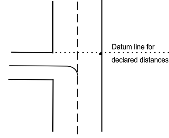
For declared distances see EHEH AD 2.13.
-
Passenger ground handling
Post: Viggo Eindhoven Airport B.V. (passenger & AC handling)
Jan Hilgersweg 2
5657 ES EindhovenTel: +31(0)40 258 1141 Email: [email protected] -
Cargo handling
Post: Viggo Cargo
Jan Hilgersweg 2
5657 ES EindhovenTel: +31(0)40 251 6133 Fax: +31(0)40 251 7910 Email: [email protected] -
Ground handling general aviation
Post: Viggo General Aviation
Jan Hilgersweg 2
5657 ES EindhovenTel: +31(0)40 258 1158 Fax: +31(0)40 235 0733 Email: [email protected]
|
Charts
|
Pages
|
|---|---|
|
ADC
|

|
|
APDC
|
|
|
AOC type A RWY 03-21
|
|
|
SID
|
|
|
SID RWY 03
|
|
|
SID RWY 21
|
|
|
RNAV SID RWY 21
|
|
|
STAR
|
|
|
STAR only from EBAW, EBBR, EBMB, EHAM, EHGG, EHLE, EHRD
|
|
|
IAC ILS Y or LOC Y RWY 03
|
|
|
IAC CDO approaches to ILS X or LOC X RWY 03
|
|
|
IAC CDO approaches RNP Y RWY 03
|
|
|
IAC ILS Y or LOC Y RWY 21
|
|
|
IAC CDO approaches to ILS X or LOC X RWY 21
|
|
|
IAC CDO approaches RNP Y RWY 21
|
|
|
VAC - VFR procedures
|
|
|
VFR TFC circuits
|
|
To be developed.